Site selection

Turn “what can
I build?” into
qualified leads.

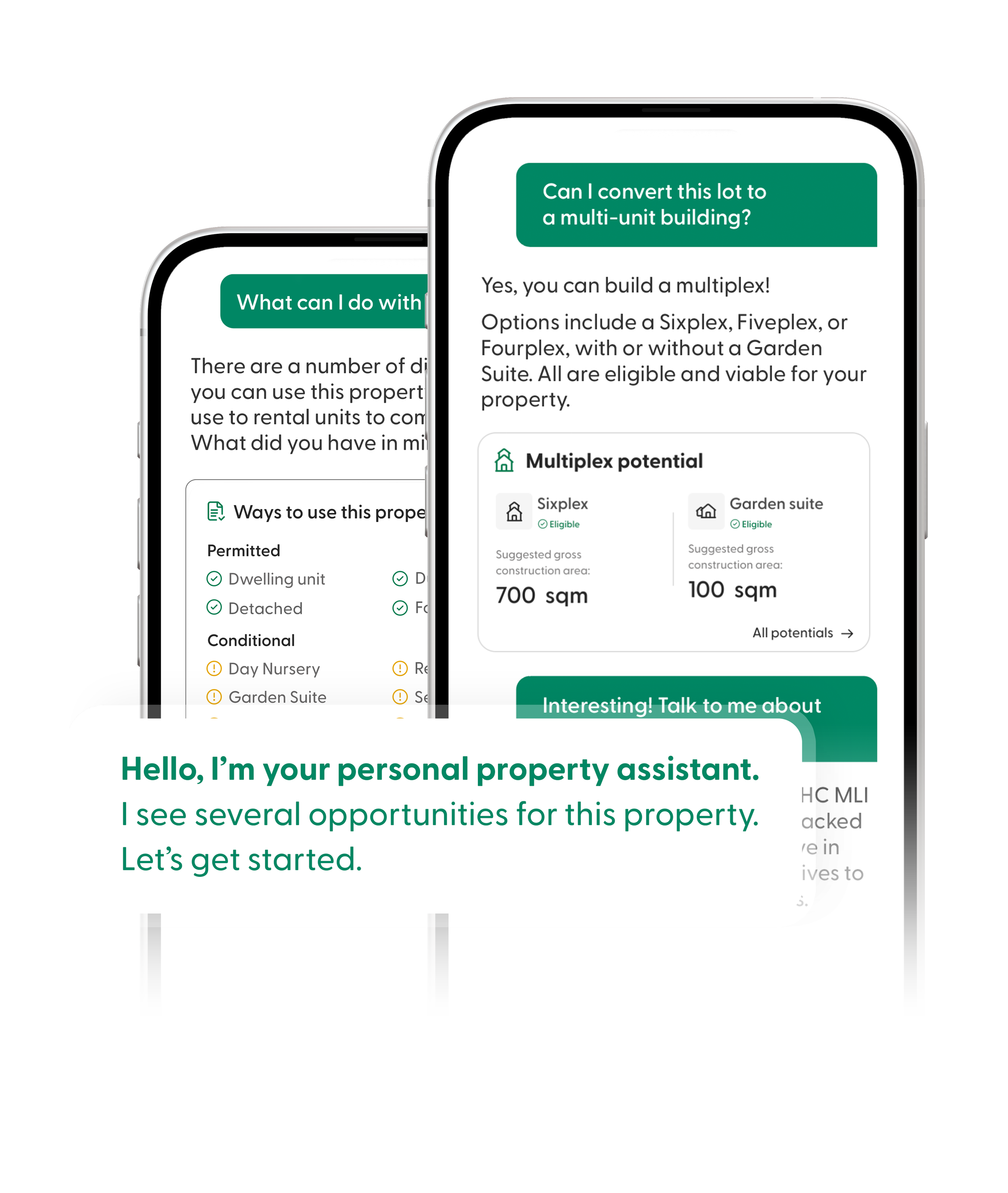
Your next lead starts with a question about a property. Answer it instantly on your own site, under your own brand, and turn it into a qualified, build-ready lead, backed by real Ontario data.
80+

Ontario municipalities covered, and growing

80+

Ontario municipalities covered, and growing

Seconds

from an address to an instant answer

24/7

lead capture, even after hours

1

embed, under your own brand

A digital map showing a land parcel with a warning that this location is partially in a flood zone. The land is labeled for agricultural use and is 10 acres in size.

Make your job easier

Search. Assess. Report.

Search entire municipalities by permitted use, dwelling type and lot criteria. Assess surrounding GIS features, like Official Plans, nearby highways, and flood zones. Then create professional reports with a click of a button.

Assess nearby GIS features
Get branded reports in seconds
Search by zoning bylaws
A digital map of a neighborhood or park area with green spaces, surrounded by roads, displayed in a web browser interface. The map is part of a mapping tool with options and filters on the right side.

Govern your data

Brand your public portal.

Launch a branded portal on your website so residents, investors, and site selectors can explore your municipality by their criteria, while staff retain secure access to internal and private layers.

Add your own proprietary layers
Control internal vs public access
Create public site selection portal

LandLogic’s site selection capabilities has been a game-changer for us. It saves our team countless hours compared to manual reviews. What used to take us days of cross-referencing multiple systems and spreadsheets now takes minutes. We can assess opportunities faster, and for a firm working on complex sites where every detail has an impact, the time savings and informational clarity are invaluable.

DevNex logo with a black background, pink and black text, and a pink icon to the left of the text.

Amin Sarang, CEO
DEVNEX Solutions Inc.

Built for your team

Why your team will love LandLogic.

Whether you’re responding to inquiries or advising clients, LandLogic helps teams move from criteria to confident decisions faster and with greater clarity.

Digital zoning report for employment light industrial zone with permitted food manufacturing use, showing a map and zoning details.

Economic Development

Faster inquiry response Stop grinding through PDFs. Just search to see exactly what's possible on any parcel.
Full integration Access zoning, official plans, demographics and 850+ more datapoints all in one place.
Professional pitching Forget manual compilation. Export investor-ready reports in seconds.
Departmental autonomy Answer planning questions instantly without chasing the Planning Department.
Bespoke data Add proprietary layers securely, expanding your library as requirements evolve.
A digital map with highlighted zones, a dropdown menu for permitted use set to 'Private school,' and a demographics report with charts showing data on children at home, household income, and immigration status.

Site Selectors

Faster first cuts Narrow long property lists by applying client-specific criteria upfront, before outreach begins.
Defensible recommendations Validate feasibility with zoning, policy, and GIS constraints—not assumptions or inconsistent sources.
Integrated research Access everything in one platform without stitching together PDFs, emails, and portals.
Client-ready reporting Generate reports that support confident recommendations and client discussions.
Flexible criteria Adjust filters and requirements as client needs evolve without restarting the analysis.

One place to research

Zoning, policy, and GIS in a single, searchable platform.

Turning a lead into an investment can take weeks of chasing maps and PDFs across planning and zoning departments. LandLogic eliminates that grind.

A map showing different locations with a dropdown menu selecting 'Manufacturing facility' as permitted use.
1

Filter by intent

Instantly search by permitted use, dwelling type and zoning criteria.

Map showing highways and railways with a toggle menu for flooding areas, overlaid on a neighborhood with parks.
2

Validate suitability

Test against 850+ datasets, like road access and environmental risks.

Map with three options: Enhanced zoning report, Preliminary site assessment, Demographic report. Arrow pointing to Preliminary site assessment.
3

Get reports instantly

Get custom branded zoning, site assessment or demographic reports.

Move faster. Work smarter.

Built for research speed, accuracy and defensible insights.

Replace manual research with one property intelligence platform that brings zoning, policy, and GIS data together in minutes.

Map with highlighted areas showing permitted residential units and parks; legend indicating conditions including daycare, short-term rental, place of worship, and property types such as detached, duplex, and triplex.

Search

Enhanced filtering.

Go beyond static mapping. Search properties by permitted use, dwelling type, and zoning criteria to see exactly what's possible with any location.

Map showing a highway, mixed-use development areas in orange, and general employment areas in gray, with a warning about proximity to a provincial highway and possible development restrictions.

Assess

Check for risks and opportunities.

Over 850 GIS datasets help assess zoning, policy, and constraints—deployed as an internal platform or a branded public portal.

A digital map displaying various site assessment reports overlayed, including reports on zoning, site assessment, demographics, and school reports.

Report

Professional reporting.

Create reports with your own branding that support fast inquiry responses, investor discussions and confident site selection.

FAQ

Answering all your questions.

We’ve answered some of the questions that we get the most, but if you have a more specific query, don’t hesitate to contact us.

Create an account instantly to get started today, or contact us to get a demo of any of our tools

Ready to get started?