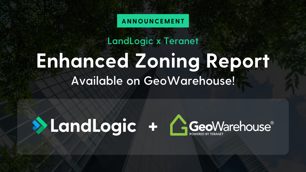
Introducing the Enhanced Zoning Report on GeoWarehouse: Deeper clarity for critical land and property decisions
While many site selection land-use inquiries start with identifying a zoning designation, more complex decisions often require a much deeper understanding of how regulations actually apply to a specific site.
For projects where risk, investment, or regulatory compliance matter, professionals need to look beyond high-level permissions and into the details: the conditions attached to permitted uses, the requirements governing buildings and structures, and the address-specific considerations that shape what can realistically be built. These details are typically buried within lengthy municipal bylaws, definitions, and supplementary clauses, making them time-consuming and difficult to interpret with confidence.
That’s why LandLogic, in partnership with Teranet, is introducing the Enhanced Zoning Report in the GeoWarehouse Store. This gives GeoWarehouse users a new level of zoning intelligence designed to support more detailed land-use analysis and regulatory due diligence. Available at launch for select cities, the Enhanced Zoning Report builds on the foundation of the Basic Zoning Report, and brings critical zoning requirements, conditions, and interpretations together into a single, structured report, reducing manual research and helping users move forward with greater clarity.
What is the Enhanced Zoning Report?
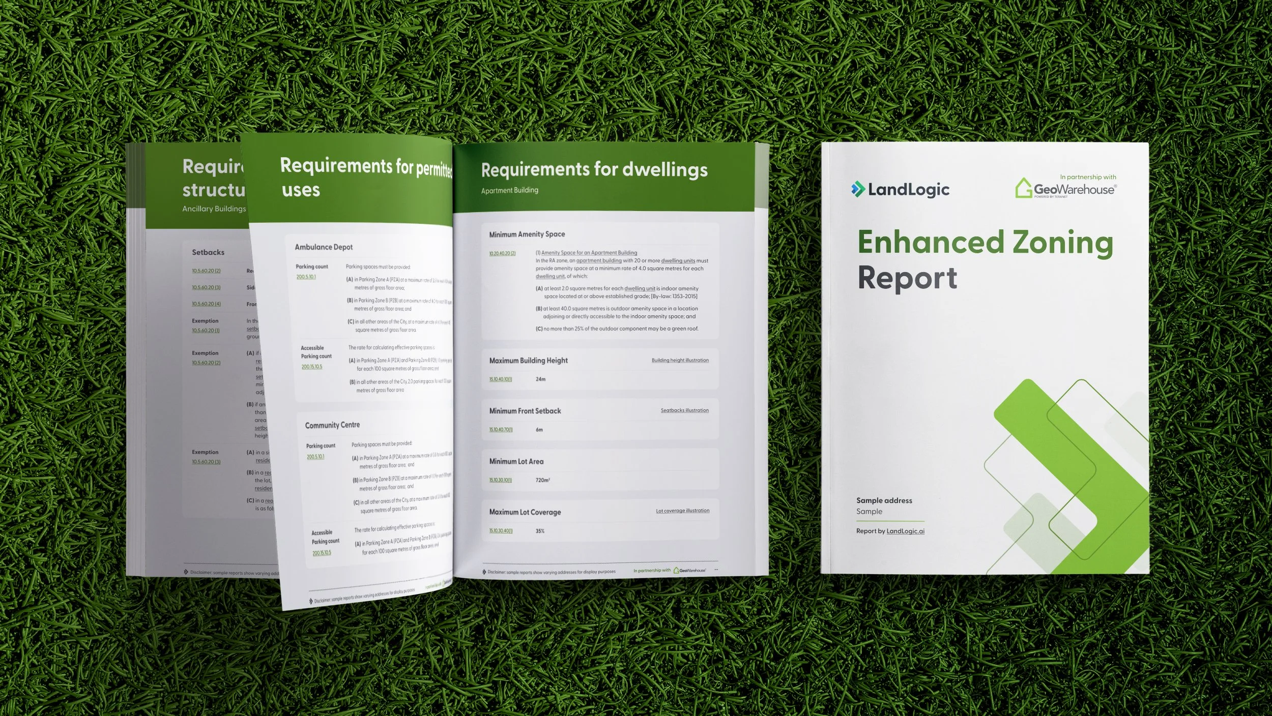
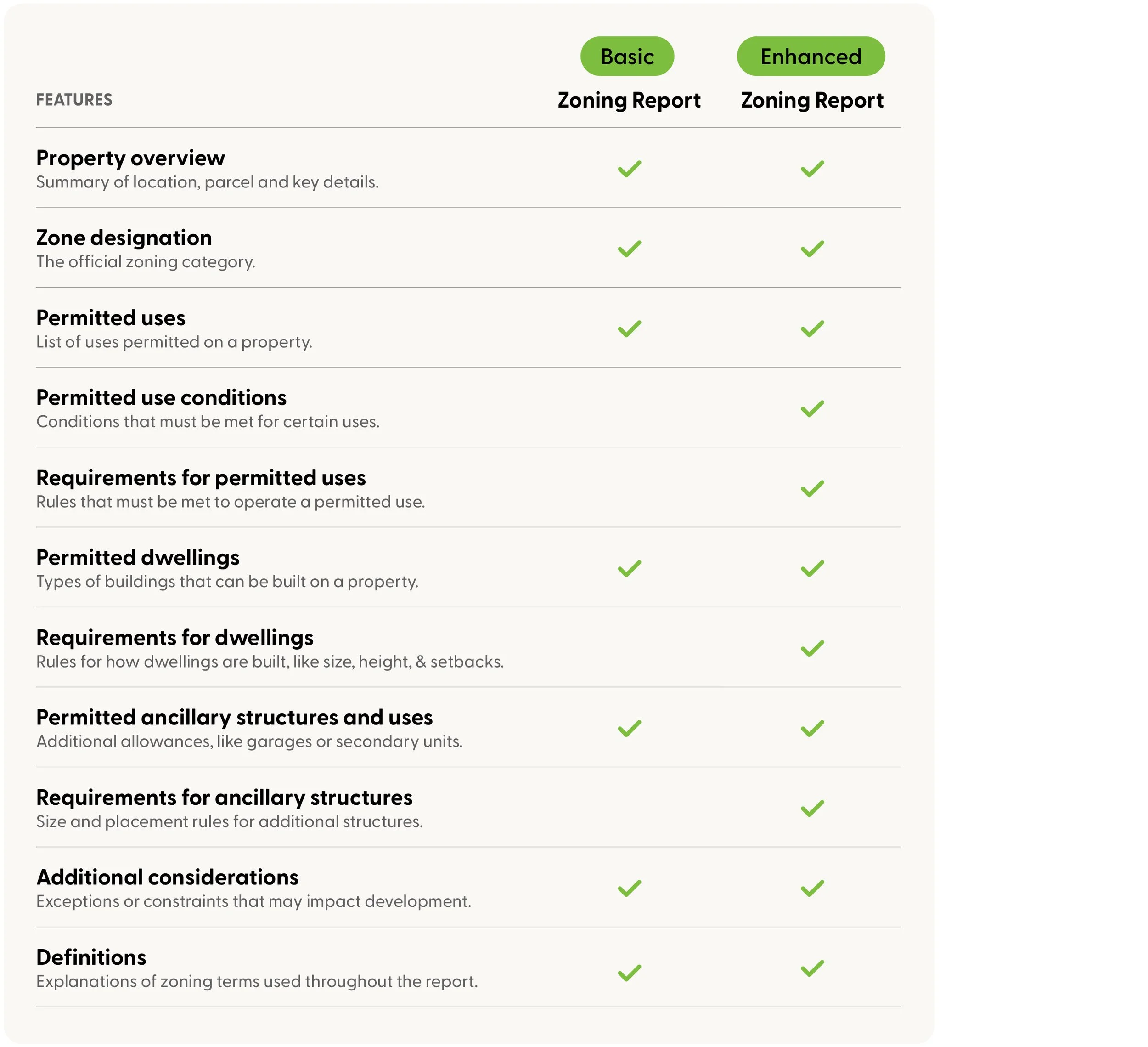
The Enhanced Zoning Report delivers a complete, address-specific zoning breakdown for a property. In addition to everything found in the Basic Zoning Report, the Enhanced Zoning Report provides:
Conditions attached to permitted uses
Detailed requirements for uses, dwellings, and structures
Key measurements and quantitative zoning standards, such as setbacks, heights, and lot coverage
Additional considerations that may affect feasibility or compliance
Location-based definitions to support interpretation
Instead of stopping at “what’s allowed,” this report answers the next, more important question: what does compliance actually require on this site?
Why this level of zoning detail matters
Zoning bylaws are dense, technical, and highly contextual. Two properties with the same zoning code can have very different development outcomes once conditions, measurements, and overlays are applied.
Traditionally, accessing this level of detail has required hours of manual work: navigating municipal bylaw PDFs, cross-referencing definitions, confirming conditions, and interpreting requirements that are often buried deep within planning documents.
The Enhanced Zoning Report brings this information together into a single output, helping users identify potential issues earlier, when they are easier and less costly to address.
How the Enhanced Zoning Report differs from the Basic Zoning Report
The Basic Zoning Report also available in the GeoWarehouse store is designed for fast, high-level clarity. It helps users quickly understand zoning codes and permitted uses, making it ideal for early-stage research, listing context, and initial feasibility screening. The Enhanced Zoning Report is designed for what comes next.
Where the Basic Zoning Report answers: Is this use permitted? The Enhanced Zoning Report answers:
Under what conditions is it permitted?
What standards must be met?
What definitions or exceptions apply?
What address-level considerations could affect compliance?
This makes the Enhanced Zoning Report especially valuable when decisions carry higher stakes with less margin for error.
Feature comparison
How it applies to you
For real estate professionals
Agents can have more informed conversations about development potential, constraints, and future value, helping clients understand not just possibility, but practicality.
For builder/developers
Before advancing a project, evaluating design alternatives, or submitting an application, developers need to understand dimensional requirements, conditional permissions, and regulatory nuances that shape design, density, and financial feasibility early enough to inform smarter go/no-go decisions.
For planners
When evaluating proposals, advising clients, or supporting pre-consultation discussions, the Enhanced Zoning Report reduces time spent interpreting bylaws and helps surface compliance considerations upfront.
For appraisers
Valuation depends on realistic development potential. By clarifying requirements and conditions tied to permitted uses, the Enhanced Zoning Report supports more defensible assessments rooted in regulatory reality, not assumptions.
Built on official data you can trust
Providing this level of zoning clarity may sound simple in concept, but it has historically been difficult to deliver. Zoning bylaws vary widely, change frequently, and are rarely structured for easy interpretation.
This is where LandLogic’s expertise matters. Every Enhanced Zoning Report is built using zoning, land-use, and regulatory information sourced directly from official municipal publications. LandLogic’s system is connected to these sources so updates flow through as soon as municipalities release new bylaws or amendments. Our planning experts structure and validate the information for clarity, while AI accelerates extraction and standardization, ensuring the data remains both current and easy to interpret. Users can rely on the Enhanced Zoning Report with the same confidence they would place in municipal websites, with the added benefit of consistency, clarity, and speed.
How to access the report
For GeoWarehouse subscribers, the Enhanced Zoning Report will be available directly through the GeoWarehouse store alongside other existing reports. At launch, this report will be available for the select cities listed below. If you are interested in getting your city added sooner rather than later, you can submit that request to our team. We are always looking for feedback!
Toronto
Mississauga
Vaughan
Markham
Newmarket
Oakville
Burlington
Innisfil
King
To be added soon after launch:
Kitchener
Milton
Ajax
Waterloo
See it in action or subscribe for updates
Book a live demo with LandLogic to explore the details of our zoning reports on GeoWarehouse, ask questions, and learn how this tool can improve your workflow. Subscribe for updates to receive news on future product enhancements and expanded coverage areas.
Ready to learn more? We always ready to chat.